Images taken from drones and satellites will be used to create maps of mining sites. This will help to plan with material removal and environmental management. And it will assist in the safe closure of areas changed by the process of mining.
We want everyone to be able to learn about our project.
This Easy Read section is explaining the goals of the m4mining (read “M for Mining”).
Should you have trouble understanding anything, email us at info@m4mining.eu
We want our research to help people working in mining.
In our project, we’re planning to help people working in mining have an easier time finding the materials they are interested in. These materials could be metals, minerals, or rocks. It can also be things that affect the safety of their workplace, for example, rocks that react with rainwater and change the environment around them.
We want to help by pointing out areas that need to be looked at more closely to make sure everything is safe and stays safe. No one should need to walk into an area that is not stable when a drone can do that job.

Our research group is made up of different European and Australian companies, research institutes, and geological surveys. We have experience in camera design, drone flight planning, monitoring mine sites by taking samples and analysing them in the laboratory and using satellite data to analyse the surface of the Earth.

We are going to look at areas where mining happens or has happened in the past. Both types of areas will show signs of how mining changed the Earth’s surface and left a mark.
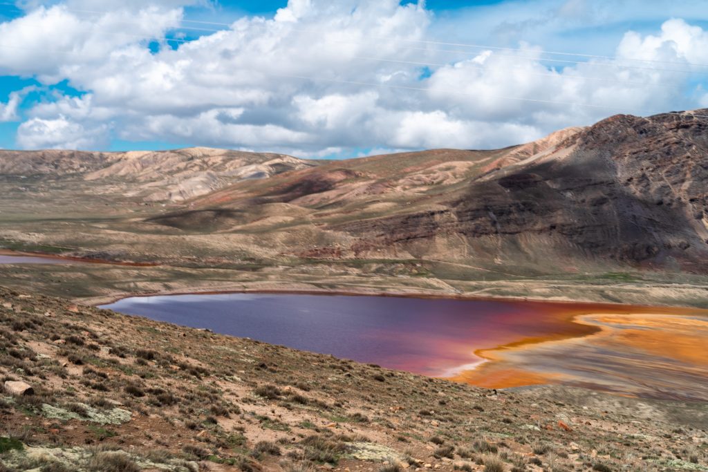
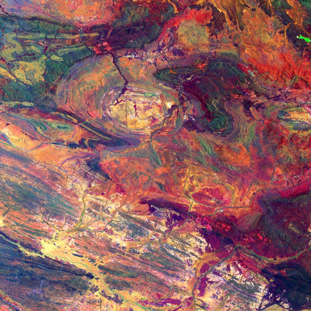
We will look at images from satellites in space and from drones flying around 100 meters above the ground. The cameras that we’re using can see far more than a human or cameras that you can buy in a normal store. We can map the position of different minerals, rock types, or waste materials and show changes in the ground surface chemistry.
We want to use drones because, with them, we can create maps in real time or within minutes. We can fly over the area of interest every day if we want to. Satellites repeat their flight over an area at defined times, sometimes every couple of days or weeks, depending on the satellite. And satellite images often have clouds in them, so we cannot see the ground properly. Drones fly below the cloud cover but the data from them are influenced by clouds as well.
Changes happen very often at an active mine site, sometimes daily. We want to be able to follow that change when it happens. That’s why we’re using drones as well as satellites.
When we use drones, we can fly closer to the ground, and we will see more details. We can also focus on areas that interest us most. The data we collect will contain more detail to analyse and will make our mineral or material map more precise.
To make the maps that we’re making easier to read for miners, we combine them with 3-dimensional models. This way, someone looking at the map can always see where the different areas are and get a feel for how they look from different viewpoints.
Our goals
A toolbox to help with quick decisions
We want to make real-time mapping from drones possible. It should be easy to understand and use for the mining industry in Europe and abroad.
Industry drone -and satellite use guidelines
We will bring together people from research, mining and companies to start a conversation on what is needed to map areas changed by mining.
Different levels of detail and how often areas are measured
We want to combine satellite and drone data in a helpful way to get information that can be used to map small areas where the material is mined and also bigger changes in mining landscapes.
Define how we look at the data and create easy-to-read maps
We will find out how to combine both drone and satellite data. We want to find ways that both methods can improve each other and find new methods that can be used for both types of data.
A team of partners
From Europe and Australia to solve the task
Our partners come from different areas and industries. We have partners from Germany, Greece, Switzerland, Sweden, the Republic of Cyprus, Norway and Australia. We work as scientists, technology developers, engineers, software developers, and geologists.


Any questions? Write an email to us:
info@m4mining.com